

 |
|
Whether you’re looking for a peaceful retreat, a home in a vibrant community, or a versatile investment, we’re here to provide the information you need. Our listings are wide-ranging, including houses, condos, farms, ranches, resorts, lodges, motels, B&Bs, waterfront properties, cabins, recreational lots, and vacant land. We primarily focus on Agassiz and Harrison Hot Springs, as well as other beautiful nearby regions. View these one-of-a-kind listings offering diverse lifestyle opportunities—the perfect blend of work, rest, and play. Feel free to contact us directly for more information on any of our featured listings. When you’re ready, we’d be delighted to show you around on a personal tour. |

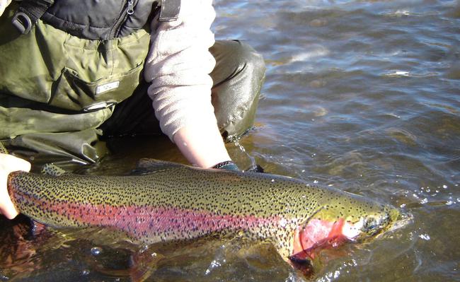
Northern Lights Lodge — Where “Once in a Lifetime Happens Every Day “WILD TROUT, NEVER CAUGHT BEFORE!” 5921 Cedar Creek Road
Likely British Columbia V0L 1N0
Likely British Columbia V0L 1N0
Acres:
12.7
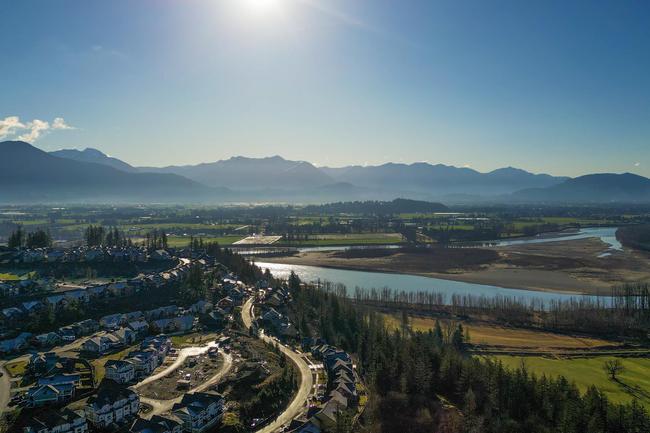
Rare 36.81-Acre Land Assembly in Scenic Harrison Mills
Woodside Blvd/Lougheed Highway, Agassiz British Columbia
Woodside Blvd/Lougheed Highway, Agassiz British Columbia
Acres:
36.69

27.8 Acres of Opportunity in Harrison Mills – Prime for Development!
1840 Woodside Boulevard, Harrison Mills British Columbia V0M 1A1
1840 Woodside Boulevard, Harrison Mills British Columbia V0M 1A1
Acres:
27.8
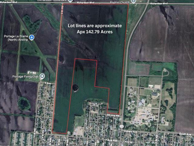
Invest, Develop, or Land Bank – Expansive 142-Acre Opportunity in Portage la Prairie
0 Tupper Street N, Portage la Prairie Manitoba R1N 3B7
0 Tupper Street N, Portage la Prairie Manitoba R1N 3B7
Acres:
142.79
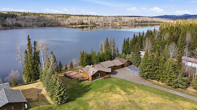
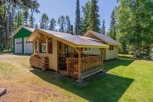
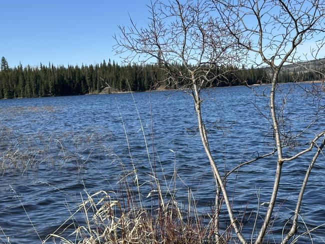
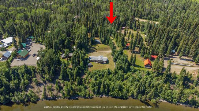
HORSE LAKE WATERFRONT ESTATE 6693 Sven Road
100 Mile House British Columbia V0K 1X3
100 Mile House British Columbia V0K 1X3
Beds:
3
Baths:
3 (full)
| 1 (half)
Acres:
2.98
Sqft:
3,082
Creek-Frontage
Rare Creekfront Acreage in Harrison Mills – 8.89 Acres Outside the ALR
1724 Lougheed Highway, Harrison Mills British Columbia V0M 1A3
1724 Lougheed Highway, Harrison Mills British Columbia V0M 1A3
Acres:
8.89
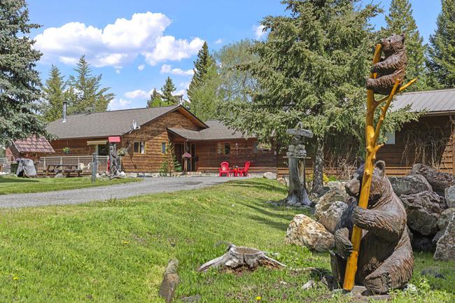
Private Horse Lake Retreat | Cedar Home + Guest Cabin on 2.21 Acres | Lake Views & Ultimate Privacy
6649 Sven Road / Horse Lake , Lone Butte British Columbia V0K 1X3
6649 Sven Road / Horse Lake , Lone Butte British Columbia V0K 1X3
Beds:
5
Baths:
4 (full)
Acres:
2.21

Unveil the Magic of Moosehorn Lodge at Uncha Lake
7463 Moosehorn Road, Southbank British Columbia V0J 2P0
7463 Moosehorn Road, Southbank British Columbia V0J 2P0
Acres:
48.06
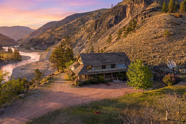
Private 16 Acre Estate with Executive Home Near Spences Bridge 8609 Merritt Spences Bridge Highway
Spences Bridge British Columbia V1K 1B8
Spences Bridge British Columbia V1K 1B8
Beds:
4
Baths:
3 (full)
Acres:
16.2

Stunning Panoramic Views Await in Naramata: Your Dream Property with Unmatched Scenery
Lot 1 North Naramata Road, Naramata British Columbia V0H 1N1
Lot 1 North Naramata Road, Naramata British Columbia V0H 1N1
Acres:
3.49
Versatile Princeton Investment Property 110 Bromley Place
Princeton British Columbia V0X 1W0
Princeton British Columbia V0X 1W0
Acres:
1.45
Sqft:
5,100
Income-Producing Full Duplex / In-Town Location / gross ROI 5.6% 455 Aspen Street
100 Mile House British Columbia V0K 2E0
100 Mile House British Columbia V0K 2E0
Beds:
6
Baths:
4 (full)
Acres:
0.2
Sqft:
2,900
Bowron Lakefront Executive Home: Custom Luxury and Off-Grid Excellence
4490 Bowron Lake Road, Bowron Lake - Wells British Columbia V0K 2R0
4490 Bowron Lake Road, Bowron Lake - Wells British Columbia V0K 2R0
Beds:
3
Baths:
2 (full)
| 1 (half)
Acres:
0.97
Sqft:
2,217

Prime Riverfront Building Lot in the Heart of Harrison Hot Springs
260 Cedar Avenue, Harrison Hot Springs British Columbia V0M 1K0
260 Cedar Avenue, Harrison Hot Springs British Columbia V0M 1K0
Sqft:
7,478
Cozy Lakeside Living with Beautiful Covered Deck Fully Fenced Yard & Room to Make It Your Own
43873 Ryall Road, Lake Errock British Columbia V0M 1N0
43873 Ryall Road, Lake Errock British Columbia V0M 1N0
Beds:
3
Baths:
1 (full)
Acres:
0.21
NEW PRICE!
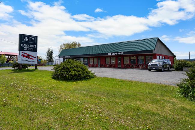
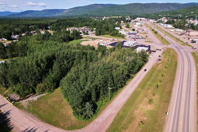
Commercial Opportunity in the Heart of the Cariboo! Strip Mall in Lac La Hache.
4842 Hamilton Road, Lac La Hache British Columbia V0K 1T1
4842 Hamilton Road, Lac La Hache British Columbia V0K 1T1
Acres:
0.61
Sqft:
4,611
Low Strata Fees, Modern Finishes and Pet-Friendly Living at Terra Estates
11-750 Hot Springs Road, Harrison Hot Springs British Columbia V0M 1K0
11-750 Hot Springs Road, Harrison Hot Springs British Columbia V0M 1K0
Beds:
2
Baths:
3 (full)
Sqft:
1,164
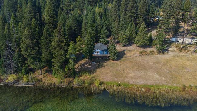
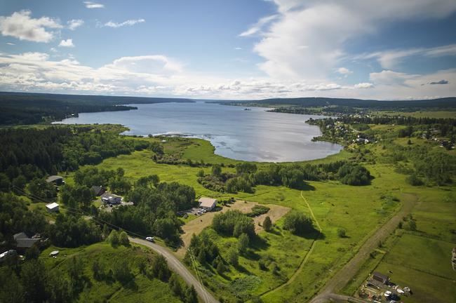
Lakefront Living on 2.6 Acres - 4 Bed Home on Tyee Lake
2496 - A Big Lake- Tyee Lake Road, Williams Lake British Columbia V2G 4J9
2496 - A Big Lake- Tyee Lake Road, Williams Lake British Columbia V2G 4J9
Beds:
4
Baths:
1 (full)
Acres:
2.6
Charming 2-Bedroom Bungalow on Sunny Corner Lot Steps from the Fraser River
435 Hemlock Ave. Hope British Columbia V0X 1L0
435 Hemlock Ave. Hope British Columbia V0X 1L0
Beds:
2
Baths:
1 (full)
Acres:
0.11
Sqft:
922

Spacious Building Lot with Scenic Harrison Lake Views
6361 Thunderbird Crescent, Harrison Lake British Columbia V0M 1A3
6361 Thunderbird Crescent, Harrison Lake British Columbia V0M 1A3
Acres:
0.3
Exceptional Bowron Lake Wilderness Retreat – Cabin, Storage, Sauna & Build-Ready Lot
Lots 3, 4 and 5 Bowron Lake Road British Columbia
Lots 3, 4 and 5 Bowron Lake Road British Columbia
Acres:
1.07

Exceptional Opportunity in Prince George: 193 Acres with Seller Financing Available! ?
Ranchero Drive, Prince George British Columbia V2K 5W6
Ranchero Drive, Prince George British Columbia V2K 5W6
Acres:
193
Build Your Dream on Sharpe Lake – 0.49 Acre Corner Lot with Stunning Lake Views
1861 Taylor Road, Bridge Lake British Columbia V0K 2K2
1861 Taylor Road, Bridge Lake British Columbia V0K 2K2
Acres:
0.49
1 Acre Affordable Lakefront Lifestyle Opportunity in Lac La Hache
4160 Lac La Hache Station Road, Lac La Hache British Columbia V0K 1T0
4160 Lac La Hache Station Road, Lac La Hache British Columbia V0K 1T0
Acres:
1.07
Five-Lot Assembly - Each lot just $ 27.780.00
4601-4617 Veterans Way, Chetwynd British Columbia V0C 1J0
4601-4617 Veterans Way, Chetwynd British Columbia V0C 1J0
Acres:
1.2
Sqft:
56,300
Double the Space, Double the Adventure — Two Premier Lots by Bowron Lake
Lot 1 & 2 Bowron Lake Road, Wells British Columbia V0K 2R0
Lot 1 & 2 Bowron Lake Road, Wells British Columbia V0K 2R0